Descriptions of Hotspots
Toronto |
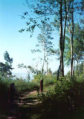
Scarborough Bluffs (Toronto) |
Durham Region (East) |
|
York Region (North) |
Halton/Peel Region (West) |
Hamilton Region (West) |
|
Please with any corrections that you think should be made and I will update the site. |
TorontoTop
Description
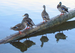
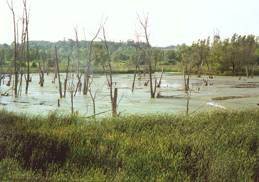
On the west side of this landfill park is all that remains of Ashbridge’s Bay, once the largest marsh on Lake Ontario. Until the 1920s the Bay occupied most of the land south of Queen St. east of Toronto Harbour and south to a narrow sandbar that extended from the foot of Woodbine Ave. to Cherry Beach. Coatsworth Cut was cut through the bar in the 1920s, creating Fisherman’s Island, and remains as the passage between the lake and Ashbridge’s Bay. At the east end of the park, south of Woodbine beach, a group of Speckled Alder are often favoured by Redpolls. (BK)
Directions
Ashbridge’s Bay Park Rd. is the continuation of Coxwell Ave. south of Lakeshore Blvd. Keep to the right to the south parking lot. TTC: Woodbine South bus goes to Woodbine Beach, or walk down Coxwell or through Woodbine park from the Queen streetcar or the Coxwell bus.
Specialties
Winter waterfowl and gulls often concentrate on the west side of the parking lot in Coatsworth Cut when ice fills the bay, but also anywhere around the park to the south.
Landbirds flock in winter to feeders immediately south of the parking lot.
Migrants concentrate in the shrubbery at the west end of the park.
Description
This mid-city ravine has been adversely affected by apartment building in recent years. The ravine begins at the north entrance to the St. Clair West subway station and continues northwest.There are some cattail marsh areas and some dry pine forest and there are numerous bird feeders behind the houses at the tops of the hills which attract winter birds. These birds may include finches, woodpeckers, nuthatches, cardinals and others. Another ravine continues south-east on the south side of St. Clair. (HC)
Directions
It can also be reached by driving to Bathurst and St. Clair, then north one block, then right (east) to the subway exit.
Description
Directions
Description
Good views of Outer Harbour and Eastern Gap into Toronto (inner) Harbour. Waterfront trail proceeds east to the base of the Leslie St. Spit. Eastern end of outer harbour is often better for both migrants and waterfowl, and is more easily accessed from the parking at the end of Regatta Rd (1). (BK)
Directions
From west take Lakeshore Blvd. East to Cherry St. south. Follow Cherry St. south to the end. From north, exit DVP on left to Don Rdwy, turn right at Commissioners, left onto Cherry St. From east take Lakeshore Blvd. – turn left at Don Rdwy and proceed as from north.
Specialties
Winter waterfowl and spring migrants.
Description
Directions
Description
This landfill has been improved to add ponds and marshes and there is a viewing platform. If you walk all the way to the end, you may find Snowy Owls and other winter birds at that season. The ponds and marshes are good for ducks and rails, while the huge old spruce trees to the north are often excellent for migratory birds. Check also the old orchard to the west of the rows of spruce trees. (HC)
Directions
By car: Exit the QEW at Kipling and go south. Cross Lakeshore and continue to follow the main road, now called Colonel Samuel Smith Park Dr. Park in the lot at the very end.
By TTC: Take the Kipling South 44 bus from Kipling Station on the Bloor Subway. The southern terminus of this route is within Colonel Samuel Smith Park. From there, walk south a few hundred metres along the road to the parking lot at the end.
Specialties
Snowy Owls in winter.
External Link
Description
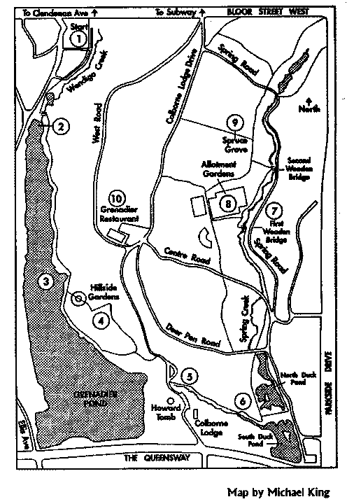
High Park’s 160 hectares (400 acres) of partially manicured parkland includes a variety of habitats ranging from wetlands to black oak savannah (now a rare habitat in Ontario).
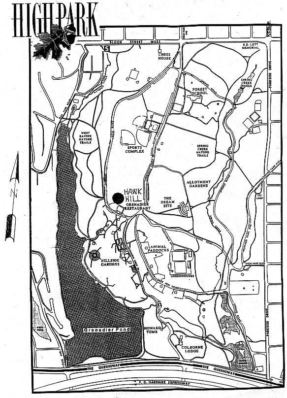
From Clendenan Ave., a short walk west of the High Park subway station, a stairway takes you down to Wendigo Way (1) where Waterthrushes are possible and Connecticut Warbler can sometimes be found on the hillsides. The marsh at the north end of Grenadier Pond (2) can have Sora and Virginia Rails. On Grenadier Pond (3) ducks and swallows are common in migration as are various herons. The Hillside Gardens (4) are good for migrating passerines including cuckoos, vireos and Orchard Orioles (which have bred here). Colbourne Lodge and Howard Tomb (5) are good for early spring migrants including Cerulean Warbler. The south end of the Park and Duck Ponds (6) are good for waterfowl and migrants. Wood Duck and Gadwall have bred here. Spring Road Ravine (7) is best in migration and in winter. Look for woodpeckers, wrens, waterthrushes and owls. The Allotment Gardens (8) are good for sparrows during migration. This is the best place in the park for Orange–crowned Warbler in October. Feeders are occasionally maintained through the winter. Look for Owls in the Spruce Grove (9) in April and October. Yellow–billed Cuckoo has bred here. There is a Hawk Watch (A) on the hill north of the Grenadier Restaurant that runs from late August through to the end of November. (BY)
Directions
By car: From the east exit the Gardiner Expressway at Jameson/Dunn and follow the signs for Lakeshore West. Turn right at Parkside Dr. and continue north roughly 2 km, then turn left on Bloor St. Turn left on High Park Ave. (the first traffic light) and park in the first parking area on your right or continue on to the Grenadier Restaurant parking lot (better for those interested in the hawk watch).
You can also access the park via High Park Blvd. from Parkside Drive and drive straight up Centre Rd. to the Grenadier lot, or turn left on Spring Rd. after entering and continue to the large parking area near the animal paddocks.
By TTC: Exit the Bloor Subway at High Park Station, walk to High Park Ave., cross Bloor St., and walk south into the park.
Specialties
Hawks in migration September through November. Waterbirds and a large selection of passerines during migration.
External Link


Description
Directions
Description
The woodlands and fields are immediately west of Humber College. (HC)
Directions
To reach the area, exit Highway 401 at Highway 27 and go north to Humber College Blvd. which is just before Finch Ave. Go left (west), enter the huge parking area and head for the south west corner where the arboretum is located. The trails begin here.
Specialties
They can be good for migrants in spring and fall and owls in winter.
Description
 Both of these large parks have close–cut lawns, but the east portion of Humber Bay East has been allowed to grow rank. As the bushes and trees continue to mature, the birding will improve. On both these man–made peninsulas, waterfowl can be seen at close range and there has been some landscaping on Humber Bay East which attracts ducks to the shoreline.
Humber Bay West offers a good view of the bay to the north. From the parking lot near the base of Humber Bay West, walk west along the boardwalk to the gazebo and beyond. In winter, many gulls can be seen from here, roosting on the yacht club docks. (HC)
(HC)
Directions
By car: From the east exit the Gardiner Expressway at Lakeshore Blvd. (immediately after the South Kingsway exit), and continue west on Lakeshore to Park Lawn. Turn left, then right at the first road beyond the bus loop. Follow this road to the parking lot (fee applies in summer).
From the west exit the QEW at Park Lawn, turn right, and continue into the park as above.
By TTC: Take the Queen 501 streetcar to Park Lawn, and walk south into the park. An alternative on weekdays is the Prince Edward 66D bus, which goes directly from Old Mill station on the Bloor Subway to the loop just inside Humber Bay Park.
Specialties
Very good for waterfowl during winter. Long–eared and Saw–whet Owls
Description
Directions
Description
Extends from Cherry Beach to the end of the Eastern Beaches near Victoria Park Av. Includes Leslie St. Spit and Ashbridge’s Bay (BK)
Directions
See features within the park.
Description
Much of this area consists of manicured lawn which has few birds, but the wet woods here are fairly extensive. Of the many good birding areas along the Humber river, none is better than here. There are ducks and gulls on the river, and land birds usually include the huge Pileated Woodpecker. Several feeders are an attraction to small birds and many of them will take seeds from the hand. Eastern Screech–Owls are common here, although they are difficult to find in the daytime. (HC)
Directions
To get there, go south from Eglinton Ave. on Scarlett Rd. for 0.3 km to Edenbridge Dr. Turn right (west) for 1.1 km and go into the James Gardens parking lot. Walk south from there.
Specialties
There is an unusual population of startling albino gray squirrels that are regularly seen in the woods.
Description
The lawns here are extensive and the park is bisected by Etobicoke Creek. Marie Curtis offers an opportunity to see waterfowl from close up at the feeding area at the river. Farther west there is an extensive woodland which is good for migrants and sometimes owls can be found here. Much of these woods are private property, but the huge gaps in the fence and the many trails suggest that there is no problem birding here. (HC)
Directions
From Dixie Rd. at Lakeshore Rd. go 0.4 km east, then turn right (south) to the park.
Description
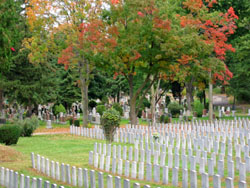
This large mid–town cemetery offers an open arboretum–like atmosphere with a wide variety of mature trees and shrubs. Visits during migration (May in particular, but also September and April) can be productive for many different warbler species, as well as flycatchers, thrushes, and sparrows. Red–breasted nuthatch is present year–round. A pair of red–tailed hawks has nested in tall conifers in the western parts of the cemetery in recent years, and the immature birds are very vocal in the summer. Bicycling is allowed in the cemetery, but pets are not. Entrance hours are posted at the gates, but generally allow access during most daylight hours. (PH)
Directions
The cemetery is accessible by car from Yonge St. two and a half blocks north of St. Clair Ave. (1), or from Mt. Pleasant Rd. north of Moore Ave. (2). You can also enter by foot from Merton St. just east of Yonge, from Bayview Ave. north of Moore Ave. (3), or from Moore Ave. just east of Welland(4), where you can connect with the Moore Park Ravine. Finally, there is also a path leading from the southwestern part of the cemetery into the Vale of Avoca (5), which is the ravine under St. Clair Ave. East.
Specialties
Can be productive for many different warbler species, as well as flycatchers, thrushes, and sparrows. Red–breasted nuthatch is present year–round.
Description
Directions
Description
Directions
Description
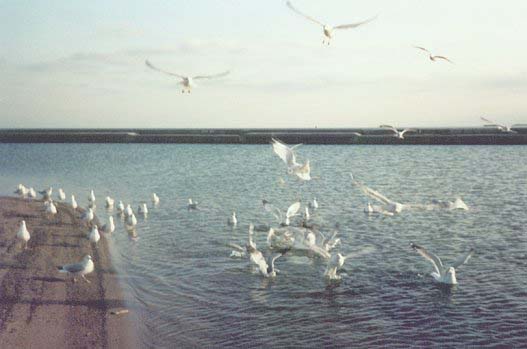
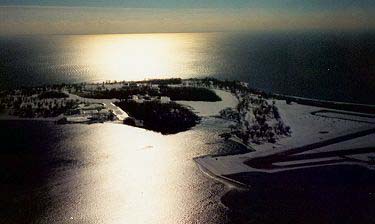
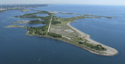 This man–made park extends approximately 5 km south into Lake Ontario. Originally conceived as a barrier spit to create a new outer harbour for expanded Great Lakes shipping, it has over the years become the pre–eminent spot on the Toronto waterfront for bird watching. The Park is termed a public urban wilderness, and as such has few amenities. Dress appropriately in winter, as conditions can be severe.
The Park is open weekends and holidays from 9 a.m. to 6 p.m. April to October and 9 a.m. to 4:30 p.m. November to March. Motorized vehicles and dogs are not permitted.
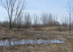 For a full day birding, start at the Baselands (2) and meander along the casual paths. Be sure to visit the central wet woods to the west of the main spine road. Proceed out the spine road and scan the harbour marina to the west and the open lake to the east for waterfowl. Moving south you will reach some embayments and marsh regeneration cells. These can be quite productive. Rafts have been provided to encourage nesting Common Terns. Peninsula D at the end of a gravel road that meets the main road 2.7 km. from the gate is the location of the Tommy Thompson Bird research Station (3) that operates every morning from April 1 to June 8, and August 5 to mid-November. See the Bird Research Station website. Further out on the Spit, Peninsulas C, B, and A, are inhabited by extensive colonies of colonial waterbirds. Large populations of Ring–billed Gulls, Double–crested Cormorants, and Black–crowned Night–Herons (4) have all contributed to the Spit’s recognition as an IBA. In spring and fall migration, all the treed protected areas can be quite fruitful for viewing small passerines. In winter, many species of gulls can be seen as well as extensive range of waterfowl. Canvasback Ducks have nested in recent years in Triangle Pond. (JC)
Directions
By Car: Take Lakeshore Blvd. to Leslie St., turn south and continue to the gate. Cars are not allowed on the Spit but parking is available at the gate (1) or outside the gate at the junction with Unwin Ave (be sure to park here if you will be staying past the closing time).
By TTC: Take the 501 Queen St. Streetcar, get off at Berkshire St. and go south on Leslie St. It is about 1.5 km to the gate.
Specialties
Excellent for all migrating birds in spring and fall. Black–crowned Night–Heron colony. Ring–billed Gull colony. Common Tern nesting rafts. White–winged gulls in winter.
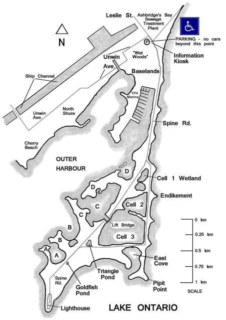
External Link
The Bird Checklist, 3rd Edition, 2006, is available from the Toronto Region Conservation Authority, or may be downloaded from the Friends of the Spit website.
Description
 A full day will be needed to explore the islands fully. The best birding area is the Island Nature Sanctuary (not signed) just north of the Island Nature School. One should also check the beaches on the west (2) and south sides for shorebirds and ducks. The woods south of the Ward's Island village can be good for migrants. (HC)
Directions
 By TTC: Take the Yonge Subway to Union Station, then the 509 or 510 streetcar south and west to Queen‘s Quay. Walk south a short distance to the ferry docks.
Ferries leave from the foot of Bay St. going to Hanlan‘s Point, Centre Island or Ward‘s Island. From mid–October to April, ferry schedules are restricted, but even at minimum winter service, ferries run hourly to Ward‘s.
By Car: on the Gardiner Expressway or on Lakeshore Blvd, exit at Bay St. and drive south to Queen‘s Quay. There are lots of parking lots nearby. There is a fee for using the island ferries ($6.00 adult and $3.50 for seniors) and to find out the sailing times you can phone (416) 392–8193. There are washrooms on the islands as well as the city side at the ferry docks. The 1st boat to Ward‘s Island is 6:35 am and the 2nd is 7:00 am Monday to Friday; Saturday 6:35 am, then 7:15 am; Sunday 8:00 am. You can pick up a schedule at the docks or check on–line and a map of the Islands is available at the entrance gate. If arriving early in the morning you must obtain your ticket from a machine just inside the gate so be sure to have $1.00 and $2.00 or 25 cent coins before you arrive at the docks as the machine does not make change and there is no place to get any.
Specialties
Excellent for all migrating birds in spring and fall. Common Tern nesting raft.
External Link
Description
Directions
Description
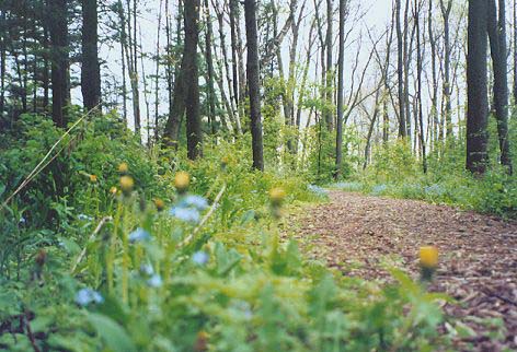
This is an area of extensive pine and deciduous forest on both sides of the Don river. Spring is the best time to visit as the parks become congested with picnickers in summer. There has been at least one pair of Pileated Woodpeckers here for decades and the woods can be good for finches, waxwings, Eastern Screech-Owls and many other species. (HC)
Directions
From Eglinton Ave. and Leslie St. go 0.2 km north, then left into the park. The roads and trails extend for 1.5 km to the north and to the north-west.
Scarborough BluffsTop
Report prepared by Rick Lauzon, March 2003, with supplemental details by Marcel Gahbauer.
Description
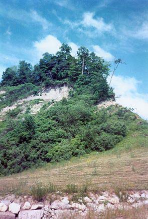
Along roughly 10 kilometres of the Lake Ontario shoreline in the east end of Toronto from Bluffer‘s Park at the foot of Brimley Rd. to East Point Park near the mouth of Highland Creek.
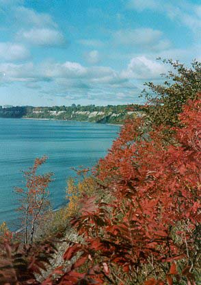
The area comprises seven parks, six steep ravines and the shallow offshore waters. The bluffs themselves are over 200‘ high in places. The drifting sand offshore limits the areas that can support underwater vegetation which can in turn attract and hold groups of diving ducks and grebes. On a calm day you can see the dark vegetated areas underwater. A scope is useful for scanning the lake from the many viewing areas at the top of the bluffs. (RL, MG)
Directions
Access is generally easier by car; public transit access often involves long walks. Details for each park are given within each entry..
Specialties
This area is best for its combination of passerines and waterfowl in spring migration. There are also some breeding species uncommon to the Toronto area. Red–necked Grebes in April and early May, Carolina and Winter Wrens in April, Orchard Orioles and Blue–gray Gnatcatchers in May and June. See specific park profiles below for further details. Bank Swallows nest along some parts of the Scarborough Bluffs, and all of Ontario‘s regularly occurring swallows can usually be found within the Scarborough Bluffs area in summer.
Description
This is a large, mostly open area at the foot of Brimley Road. There are several parking areas (which have metered fees on the weekend). TTC access is via Kingston Rd 12 to Kingston & Brimley, followed by a 15 minute walk south along Brimley to the base of the bluffs.
The park has a variety of resident gulls, ducks, geese, and has Trumpeter and Mute Swans in all seasons. Migrating waterfowl may stop here briefly in small numbers, and diving ducks can occasionally be viewed at close range in winter. The rock-protected headlands enclose several beaches and lagoons, which can attract migrants such as Pied-billed Grebe and the odd sandpiper. In general, this is a very busy park, so birds don’t get much rest. The wooded slopes of the bluffs and the ravine on either side of Brimley Rd offer some passerine activity during migration. Occasionally, a rarity will show up at the park, such as the King Eider in April 2001. Deer travel the shoreline from the east to as far as Bluffer’s Park. The stormwater management pond in the western part of the park has become attractive to both Caspian and Common Terns, as well as Black-crowned Night Heron and Wood, Duck Willow Flycatcher and Northern Mockingbird have colonized the shrubby areas nearby. (RL, MG)
Directions
From Highway 401, go south on McCowan at Kingston Rd. going southwest to Brimley Rd., then south on Brimley into the park.
Specialties
Red–necked Grebes in April and early May, Carolina and Winter Wrens in April, Orchard Orioles and Blue–gray Gnatcatchers in May and June. See specific park profiles below for further details. Bank Swallows nest along some parts of the Scarborough Bluffs, and all of Ontario's regularly occurring swallows can usually be found within the Scarborough Bluffs area in summer.
External Link
Description
This is a small grass area atop the bluffs. There are wide–open areas for lake viewing, and you will see some hawks (mostly harriers) cruising by in the fall. The park is separated from Bluffer‘s Park by a steep wooded ravine. (RL, MG)
Directions
At the south end of Cathedral Bluffs Dr., which is the extension of McCowan Rd. south of Kingston Rd.
Description
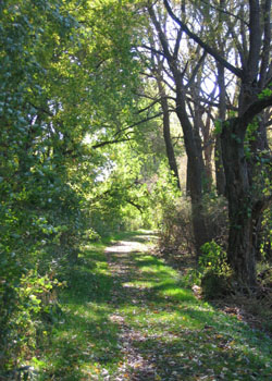
Cudia Park has wooded hillsides with mature Beech and Maples. It also has more open places with saplings and some spruce. There are two very steep sided ravines within the park and there is good lake viewing from the top of the bluffs. From here and eastward you will see many Red-necked Grebes in April. You’ll also find Winter Wrens in April and good warbler hunting in May. At the highest end of the western ravine you may find a Carolina Wren. This park, and several parks and ravines east of it, makes up an extended territory for a pair of Pileated Woodpeckers.
 This aspen grove at the southeast corner of Cudia Park can be a great migrant trap on spring mornings, and also provides a good vantage point from which to scope waterfowl offshore.(Photo by Marcel Gahbauer.) (RL, MG)
Directions
South from Kingston Rd. on Pine Ridge Dr., then right on Meadowcliffe Dr. to a parking lot. TTC access is via a 10–minute walk along the route described above, from the Markham Rd. 102 route along Kingston Rd.
Description
 From the parking lot, there is a trail running eastward to the mouth of Highland Creek and then northward up a wooded valley to Colonel Danforth Park. Near the start of the trail is a large landfill pile from which raptor migration can be observed in the fall. Just beyond Highland Creek is an area where many gulls loaf – mostly Ring–billed, Herring, and Great Black–backed, but there may be others on occasion, plus often some Caspian and Common Terns in summer. Just north of the railway bridge both Great Crested Flycatcher and Blue–gray Gnatcatcher have nested in recent years.
To the west of the parking lot is a large undeveloped grassy area at the top of the bluffs, with just a few trees. Swallows (Tree, Barn, Northern Rough–winged, Bank, and occasionally Cliff) are common, as are flycatchers (Willow, plus Eastern Kingbird, and in wooded areas Eastern Wood–Pewee and Great Crested Flycatcher). This area was burned several years ago and subsequently was popular with Eastern Meadowlark, Bobolink, American Woodcock, Field Sparrow, and Black–billed Cuckoo for a few years. The shrubs have grown considerably since then, and these species are becoming much less common again, with Brown Thrasher, Gray Catbird, Song Sparrow, Yellow Warbler, and Common Yellowthroat now more dominant. Check the areas just west and south of the parking lot for nesting Orchard Orioles in early summer. American Kestrels also nest in the area most years.
 Southwest of the main parking lot at East Point is a pond with remarkably clear water. Wood Duck and Belted Kingfisher occur regularly, while shorebirds making regular stops while on migration include Solitary Sandpiper and both Lesser and Greater Yellowlegs. Blue-gray Gnatcatcher and Orchard Oriole have nested along the perimeter of the pond in recent years. (Photo by Marcel Gahbauer.) (RL, MG)
Directions
There is a parking lot at the south end of Beechgrove Dr. Weekday TTC access is via the Scarborough 86D bus to Beechgrove and Coronation, followed by a 10 minute walk east/south along Beechgrove to the park; on weekends the closest bus is the Lawrence East 54A (to Lawrence and Beechgrove).
Specialties
The wooded areas near the edge of the bluffs can be very productive for fall warblers, and the open areas are probably the best place in Toronto to observe Palm Warblers in late September/early October.
Description
 The grounds of the Guild Inn (now closed) form the centrepiece of Guildwood Park. The area around the Inn includes dozens of architectural relics of demolished Toronto buildings, and a variety of flower gardens (popular with wedding parties in summer). The surrounding park–land has a good mix of mature trees, bushes and grassy areas. The best area for birding is the southern perimeter, between the bluffs and the fence marking the edge of the Inn property. The shrubs and trees there, especially toward the west end of the fence, can be full of warblers and other songbirds in spring, especially following rainy nights. In mid–May, Scarlet Tanagers can often be seen in the area around the main south gate of the Inn property. Carolina Wrens have nested recently in the southern part of the Guild Inn property, and Blue–gray Gnatcatchers may also be summer residents. Northern Shrike can be seen along the bottom of the bluffs in late March and early April. From the east side of the park there is a trail which leads down to the foot of Galloway Rd and to a path along the lakefront (see Ravine Drive, above). Just east of this point is an area of underwater vegetation which seems to hold a variety of birds (Red–throated Loon, Brant) which would otherwise have passed through fairly quickly. For a look at what birds may be on the water here, just stop on the street at a few spots along Guildwood Parkway east of Galloway Road. Red–breasted Mergansers sometimes congregate here in impressive numbers in April and into early May. The forested area west of the Guild Inn is often very wet in spring, and is a great place to look for both spring migrants and resident species such as Pileated Woodpecker and Great Crested Flycatcher. Sharp–shinned Hawks can also be found quite regularly, and there are periodic sightings of Peregrine Falcons, especially along the bluffs.
 West of the Guild Inn are numerous paths through forested areas, some of them well marked with wood chips, and others less formal. (Photo by Marcel Gahbauer). Guildwood Park offers a mixture of wet forest, views of the lake over the Scarborough Bluffs, and manicured lawns and gardens around the old Guild Inn. The overgrown hedge/fence line shown in the photo is located near the edge of the bluffs, southwest of the Guild Inn. (RL, MG)
Directions
Access to the large parking lot at the Guild Inn is from Guildwood Parkway, as is a smaller parking lot just east of Galloway Rd. TTC access is great, with the Morningside 116 route making several stops along the edge of the park, including at the gates of the Guild Inn.
Specialties
This can be one of the best places in Toronto for observing warblers in spring. Like many migrant traps, it is most productive on mornings following heavy overnight rain. Be sure to look low for Wilson’s, Chestnut–sided, Black–throated Blue, and Magnolia Warblers; in the few spruces for Bay–breasted, Blackburnian, and Cape May Warblers; and high in the ashes for Yellow–rumped and Tennessee Warblers.
Description
Directions
Description
Just east of Sylvan Park is a thin strip of a park that runs along the top of the bluffs. Parking is on the street at the south end of Rogate Place. Even though the park is just a few large trees wide, Pileated Woodpeckers can be found here. Winter Wrens are common in the early spring. (RL, MG)
Directions
Specialties
This point on the bluffs is the best place to view hundreds of Red-necked Grebes in April.
Description
 A relatively quiet park at the end of Sylvan Avenue deep into Guildwood Village. This park is at the top of the bluffs and overlooks the areas described as Ravine Dr. above. There is a well-treed hillside with resident Great Horned Owls and a more open area in front with scattered clumps of trees and brush. There are good numbers of warblers here in spring, and Orchard Orioles have been a recent attraction. A colony of Bank Swallows inhabits the face of the bluffs. The swallows are particularly easy to photograph, if you’re so inclined, as the edge of the bluffs curls around to a point right beside the colony. (RL, MG)
Directions
Parking on the street is limited, but is a better option than the 10–15 minute walk from the nearest TTC stops at Markham & Kingston (Markham Rd. 102) or Guildwood Parkway & Prince Arthur (Morningside 116).
Durham Region (East)Top
Description
 Corner Marsh is situated at the mouth of Duffin’s Creek. There is a trail south towards the lake through the field and woodlot to access the area where Duffin’s Creek empties into the lake. This trail meets the Waterfront Trail and eventually winds its way east across the creek to Rotary Park. (JS, RP)
Directions
 There are two ways to access the Corner Marsh. The west side is as follows: From the 401 exit at Brock Road in Pickering, drive south to Bayly Street and turn left/east. Continue along Bayly to Squires Beach Road. Turn right/south on Squires Beach and proceed to Mackay Road. Turn left on Mackay and proceed to the stop sign. There is no street sign but turn left on what used to be signed as Montgomery Park Road. (This area has been significantly changed by the expansion of the pollution control plant at the foot of Squires Beach Road.) Drive east to where the road bends right. There is very limited parking on this corner. Walk into the field and proceed east until the vegetation on your left opens up so you can view the marsh.
The east side of Corner Marsh and the mouth of Duffin’s Creek can be accessed from Rotary Park as follows: From the 401 exit at Westney Road, drive south to Lake Driveway. Turn right and follow Lake Driveway to the Rotary Park entrance on your right.
Specialties
Good shorebird habitat in spring and fall. The open water yields many waterfowl in season. The field and woodlot have nesting passerines but are also good in migration. Gulls congregate in the area around the mouth of the creek year round.
Description
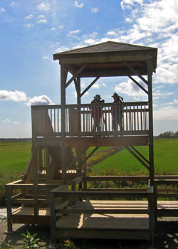
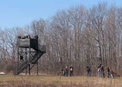
Cranberry Marsh is a large natural pond with cattail marshes around its borders. At all seasons the large pond holds waterfowl, although increased vegetation in recent years restricts the view, while the forest edges are excellent for migrants. There are two boardwalks to viewing platforms on the west side. In the fall in September and October, a well–organized hawk watch takes place on the south platform. Days with a few cumulus clouds and a north or north–west wind are best. Nearby Lynde Shores woodlot is a delight for children, because the small birds take seeds and nuts right from the hand.
Directions
From the 401 exit at Salem Rd. in Ajax, drive south to Bayly St. and turn left/east. Continue along Bayly past LakeRidge Rd. to Hall’s Rd. (easy to miss), the next street going south. Turn south on Hall’s Rd. and proceed to a small Central Lake Ontario C.A. sign on your left 100 m before the road ends at Lake Ontario. There is some roadside parking here. A loonie is requested as a Conservation Area donation. Take the path east past bird feeders to reach the south observation platform; a side trail just before you reach the marsh leads south to the lakeshore and a rocky barrier beach with willow trees and a controlled outflow from the marsh.
Specialties
Migrating hawks in the fall.
Description
Frenchman’s Bay has extensive yacht clubs close to Lake Ontario, but the north end is still in a wilderness state. This area can be excellent for shorebirds in August and September. Waterfowl will also be present and the small woods often hold migrants. (HC, JS, RP)
Directions
Exit highway 401 at White’s Rd., then go south 0.3 km, then left on Bayly St. Go east on Bayly to Liverpool Road. Turn right on Liverpool and proceed south to Commerce Street. Turn right on Commerce to Front Road. Turn left on Front and then right into the parkette parking lot.
Specialties
In winter, once the bay freezes, many gulls can be seen from the parkette on the east side. Iceland, Glaucous, Lesser and Great Black–backed gulls are regulars. Waterfowl congregate in any open areas along the edge of the ice.
Description
Directions
Specialties
Migrating hawks in the fall.
Description
Hydro Park (actually Alex Robertson Park) is located just north of the Pickering Generating Station at the foot of Sandy Beach Rd. The park consists of hiking trails through the regenerating open spaces and woodlot around the east side of Hydro Marsh. (JS, RP)
Directions
Exit highway 401 at White’s Rd., then go south 0.3 km, then left on Bayly St. Go east on Bayly past Liverpool Road. Turn right at Sandy Beach Road and proceed south past the bridge to the parking lot on the right.
Specialties
The large wetland area attracts many waterfowl and, if extensive mudflats develop, shorebirds in migration. The woodlots and regenerating open areas yield migrating passerines.
Description
Liverpool Road still allows lake viewing access but there is better birding at Frenchman’s Bay located to the west and Hydro Marsh to the east. The south end of Hydro Park can be accessed via Pickering’s Millennium Square along the waterfront trail. This area of the Hydro Marsh is being rehabilitated with natural plantings, a tern raft, and viewing platform. (JS, RP)
Directions
Exit highway 401 at White’s Rd., then go south 0.3 km, then left on Bayly St. Go east on Bayly to Liverpool Road. Turn right on Liverpool and proceed south to a parking lot on the left.
Description
Lynde Shores CA consists of a small woodlot with trail access to both Cranberry Marsh and Lynde Creek Marsh. The area provides excellent habitat for nesting birds and acts as an important stopover point for waterfowl and shorebirds migrating along the north shore of Lake Ontario. (JS, RP)
Directions
Exit highway 401 at Salem Road in Ajax. Drive south to Bayly Street and turn left and proceed past Lakeridge Road. The Lynde Creek CA parking lot is located on the south side of Bayly past Hall’s Road. This lot is metered parking and is well monitored.
Specialties
The woodlot contains passerines in migration and is an ideal place for children to hand feed chickadees at any time of the year. The fields between the woodlot and the marsh areas provide habitat for nesting sparrows and bobolinks.
Description
This park consists mainly of large open mown grassy areas interspersed with treed hedgerows, but also holds a small east–facing beach on Lake Ontario, and a forested creek valley. The hedgerows and forested areas attract migrants (warblers, vireos, thrushes, sparrows, etc.) in spring and fall. Petticoat is a good spot for fall hawk–watching due to its lakeshore location with unobstructed views. Waterfowl, such as loons, mergansers, and other ducks, can be observed off the beach on the east side of the park, or at greater distance from the bluffs on the southern side of the park, particularly in spring and fall. Not very birdy in summer (Victoria Day through Labour Day) when park use is heavy (and fee is charged for entry). Entry is free during the remainder of the year. (PH)
Directions
Exit the 401 at White’s Rd. in Pickering (exit 394) and go south. In summer you can drive right in. In other seasons, park at a Pickering city park on the west side of White’s Rd. just north of the conservation area gate. The Waterfront Trail runs through Petticoat and allows bike or foot access from both east and west.
Specialties
Hawks in the fall. Waterfowl. Migrating birds in spring and fall.
Description
Pringle Creek feeds into the north end of Whitby Harbour and the bridge area on Brock Street provides visual access to both sides of the creek. (JS, RP)
Directions
Exit highway 401 at Brock Street (exit 410) and proceed south (3 streets) to the bridge over Pringle Creek.
Specialties
Waterfowl, gulls, and shorebirds have been observed on both sides of the bridge over the creek.
Description
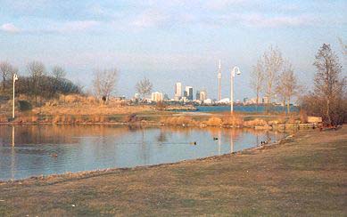
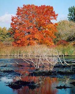
 The centre of Second Marsh is a small lake. On the north is an extensive woodland, with well–developed trails and a viewing tower (5). On the east, after parking in the GM parking lot (6), visit another viewing tower (4), then walk the trail down to Lake Ontario. In fall formerly the west side often had extensive mud–flats, attracting hundreds of shorebirds, and they may be good again someday. Little Gulls may congregate at this marsh among the many Bonaparte‘s Gulls in April–May. (HC)
Directions
 Exit from the 401 at Harmony Rd. (Exit 419) in Oshawa. Go south on Farewell St. to Colonel Sam Dr. Go east on Colonel Sam Dr. to the parking lot at the GM Headquarters (6). Park in the west parking lot close to the marsh. The east platform is located here (4). To see the Lake Ontario waterbirds proceed along the path from the parking lot south to the lakeshore.
Description
Squire‘s Beach has extensive cattail marshes bordering Duffin‘s Creek. The river broadens into a large pond a few hundred metres before reaching Lake Ontario. This area is good for shorebirds and even better for waterfowl as well as Great Blue Herons and Osprey. Check the bushes for land birds and follow the short trails to the edge of the pond to see the birdlife there. More birds may be seen by going south to the end of Frisco Rd. and walking east along the bicycle path. (HC)
Directions
At Montgomery Park Rd. go east on McKay Rd. 0.3 km, then angle south-east on Jodrel Rd. to Montgomery Park Rd. Go left here and park near the intersection on the east side.
Description
 This small oasis of forest was saved from destruction by fund–raising from birders. Especially in spring, migrants are concentrated here. There are several trails through the woods and a sightings book. For at least two decades, Great Horned Owls have nested here, although one must spend time looking in the pines to find them. To the east is Corbett Creek (2) and a productive marsh (3). The semi–open area to the north (4) has now been acquired by the Thickson‘s Woods Land Trust and trails are being developed. (HC)
Directions
 From Highway 401 exit at Thickson Rd. and go south past Wentworth St. Park on the road outside the Waterfront Trail (1).
Specialties
Great–horned Owls nest. Superb migration area with the possibility of a warbler fall–out in spring.
Description
 This swamp can be viewed from the Scarborough Pickering Townline Road. White–fronted Goose has occurred here in November with the many Canada Geese. (JS, RP)
Directions
From the west, exit Hwy 401 at Port Union Road and proceed east along Kingston Road (Hwy 2) past Port Union/Sheppard to Altona Road. Turn left at Altona and go north to Finch Ave, turn west/left past Altona Road until you reach Scarborough Pickering Townline. Turn right and park just south of the railway tracks.
From Hwy 401 in Pickering, exit at White’s Rd., go north to Finch Ave, turn west/left past Altona Road until you reach Scarborough Pickering Townline. Turn right and park just south of the railway tracks.
Description
This area is the remnants of man–made ponds but the regenerated wet area and woodlot to the north are worth a look for nesting Wood Ducks and migrating Solitary Sandpiper and passerines. (JS, RP)
Directions
From the west, exit Hwy 401 at Port Union Road and proceed east/left along Kingston Road (Hwy 2) past Port Union/Sheppard to Altona Road. Turn left at Altona and go north to Finch Ave, turn west/left past Altona Road until you reach Scarborough Pickering Townline. The ponds are located on the northeast corner of Finch and Townline.
From Hwy 401 in Pickering, exit at White’s Rd., go north to Finch Ave, turn west/left past Altona Road until you reach Scarborough Pickering Townline. The ponds are located on the northeast corner of Finch and Townline.
Description
Despite the fact that Whitby Harbour is entirely developed with no “natural areas”, it’s still worth a look in all seasons. Gulls frequent the jetty area and waterfowl are abundant before freeze up and after spring thaw. Wintering waterfowl can be observed on the lake but the pier access can be slippery.
Directions
From Highway 401 take exit 410 to Brock St. and go south three streets to the bridge over Pringle Creek and continue to the next left into the parking lot at the mouth of the harbour.
Specialties
Often good for Great Black-backed Gulls especially roosting on the jetty (1).
York Region (North)Top
Description
This area holds open fields and woods. Guided nature walks, including “owl prowls“, are led by staff members. The multiflora rose bushes north of the building are good for Cedar (and perhaps even Bohemian) Waxwings and Pine Grosbeaks have been found here too. For information call (416) 667–6299. (HC)
Directions
North on Highway 400 to Major Mackenzie Dr., then left (west). Continue past Weston Rd. to Pine Valley Dr. then turn left (south). The entrance is well–signed to the right.
Description
Directions
Halton/Peel Region (West)Top
Description
Directions
Description
Directions
QEW Exit 111 to Bronte Rd., east to Lake Ontario end of Bronte Rd. (former Hwy. 25) across Lakeshore Blvd. in Oakville.
Specialties
Red-necked Grebes nest here in the outer harbour. There is a Cliff Swallow colony nesting on the restaurant building.
Description
This area holds woodlands, fields, and a big reservoir. It can be good for small owls and hawks in winter. Field birds like Savannah Sparrows are common. In the past, the pond had a muddy shoreline which was excellent for shorebirds. (HC)
Directions
400m north of Steeles on west side of Highway 50 (250m south of Gore Rd.) - go through the little gate and follow the road to the creek valley.
Description
Paletta is the current name of this park as of 2001. It is a large estate which was taken over by the city for taxes. While the manicured lawns have little in the way of birds, the wooded areas to the east are good and one can get a good view of Lake Ontario. The walk along the wood chip trail to the lake often has Carolina Wrens and is good for migrants spring and fall. Red-necked Grebes are always present on the lake from March to December. There is a circular trail, about one kilometre in length, with bridges at both the north and south ends which cross Shoreacres Creek. (HC)
Directions
The park is about halfway between Walker’s Line and Appleby Line in Burlington, on the south side of Lakeshore Road.
Description
This is an excellent area for birds, especially in winter. There are fields, extensive forests, cedar bogs and ponds. Wild Turkeys can be found here, or at feeders in winter a little further west especially along Centreville Creek Avenue. Common Ravens have been reported here in winter and it is the best place to find Evening Grosbeaks, Purple Finches and perhaps even a Black-backed Woodpecker. (HC)
Directions
Go north on Highway 50 to Patterson Sideroad just before the town of Palgrave. Turn left and at the next intersection turn right to see the extensive woods.
Description
Directions
Description
 At this birding destination, you will find a fairly extensive woods and a marsh with a viewing platform, allowing you to see the ducks and shorebirds. People birding here especially in the morning should visit the lower sections of Turtle Creek because it gets the morning sun and warms up a lot quicker than much of Rattray Marsh, with subsequent early insect (and bird) activity. (See the map on the external link below.) (HC)
Directions
Exit the Queen Elizabeth Way at Mississauga Rd., and go south to Lakeshore Rd. Go right (west) on Lakeshore for 3 km to Bexhill Rd., then left (south) on Bexhill for 0.8 km. Near the parking lot, you will see a map of the area. Alternatively, exit at the Erin Mills Parkway south and turn left (east) on Lakeshore Rd. to Bexhill Rd.
Specialties
Red-necked Grebes are often present on the lake and the woods are excellent for birds year round.
Hamilton Region (West)Top
Description
Directions
QEW to Exit 71 in Grimsby; follow Christie St./Mountain St. (Reg Rd. 12) up the escarpment. At the crest of the hill, opposite the Eastern Rite church, take Ridge Rd. right (West) (Reg.Rd. 79) 2.4 km. to Quarry Rd., follow signs to Beamer Conservation Area. Do not park in the small parking lot at the entrance but continue into the CA and park in the lot inside.
If travelling from west of Hamilton take Hwy. 403 to Lincoln Alexander Parkway in Ancaster, take The Linc east to its end at Mud St., follow Mud St. across Hwy. 20 all the way to Woolverton Rd. (approx. 20 km), turn left (north) on Woolverton to Ridge Rd. W., then go right (east) approx 2.0 km on Ridge Rd. to Quarry Rd.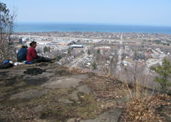
Specialties
Hawks in spring migration. Red-bellied Woodpeckers nest here.
Description
Directions
Description
Directions
Description
Directions
Specialties
Nelson‘s Sharp-tailed Sparrows in October.
Description
Directions
Specialties
There is a Caspian Tern colony on a small island in the harbour.
Description
Directions
QEW Exit 78 to Fifty Rd., north to North Service Rd., follow signs (fee during most of year).
Description
Directions
Description
Directions
Hwy. 403 from Hamilton to Toronto or Plains Rd. (Burlington) northeast to Waterdown Rd. / LaSalle Park Rd., right (east) to end of LaSalle Park Rd. at Hamilton Harbour. Can also be reached by taking North Shore Blvd. southwest along Hamilton Harbour from QEW Exit 97.
Description
Directions
680 Plains Rd. W., Burlington – From Hamilton follow York Blvd. past Dundurn Castle and over High Level Bridge. York Blvd. becomes Plains Rd. W. From Hwy. 403 take Hwy. 6 exit (to Guelph), turn right at first traffic light after ramp and follow the signs.
Description
Directions
Description
Directions
Specialties
Large colony of water birds on the berms inside the harbour.
Description
Directions
Eastport Dr. to Beach Blvd. to Van Wagners Beach Rd. (follow signs for Confederation Park), or QEW Exit 88 to Centennial Parkway (Hwy. 20, Stoney Creek) to Van Wagners Beach Rd. then west (toward Skyway Bridge). Park near Hutch’s Restaurant.
Specialties
Yeagers when there is an East wind.
Description
Directions
Exit the QEW at Centennial Parkway, head north, then turn left at North Service Rd. At the first lights turn left, then at the second turn right. The river inlet is at the intersection and parking is at the side of the road. HOWEVER, make sure you pull over as far as you can, as it is a very busy road.
Specialties
Tern colony and overwintering waterfowl.
Description